Derry Wood – Ballagh 5 KM Run / Walk.
Durrow – Fitness Routes.
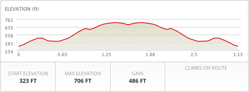
DISTANCE – 3.13 miles / 5.03 Kilometres
CLIMB – 486 ft
ELEVATION – 706.23 ft
START / FINISH COORDINATES: 52.837395, -7.380343
TURNAROUND COORDINATES: 52.820708, -7.399614
This is a 3.13 mile route in Durrow, Co. Laois. The route has a total ascent of 486.97 ft and has a maximum elevation of 706.23 ft.
Starting at the entrance to the Derry Wood, Durrow, opposite Knockatrina Wood, this is really a route of two halves.
The first section of the challenge is an almost continuous climb, save for a couple of level sections, and a gradual descent to the halfway / turnaround point. With the hardest of your work done, the return is for the largest part, a downhill track.
Having climbed the Ballagh Hill section on the outward section, some of the scenery on offer, thereafter, is truly spectacular, especially on a clear day, and more so on the homeward leg.